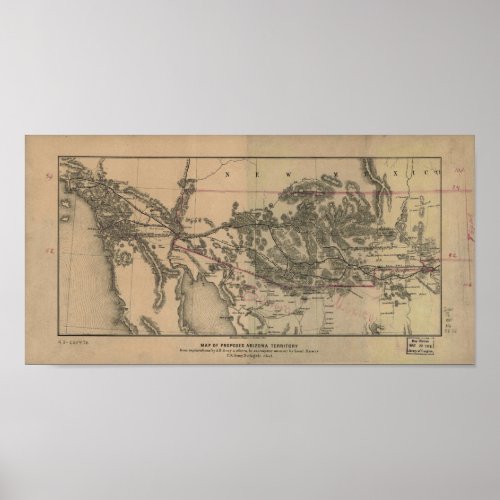
1857 Map of the Proposed Arizona Territory & Rails Poster

- from our Affiliates


Map of proposed Arizona Territory. From explorations by A. B. Gray & others, to accompany memoir by Lieut. Mowry, Delegate elect. Gray, A. B. 1820-1862. (Andrew Belcher), CREATED/PUBLISHED Cin[cinnati], Middleton, Wallace & Co. Lithos. [1857] Map of the U.S. Southwest and part of northern Mexico extending from El Paso, Tex., to the Pacific Ocean. Shows proposed and practicable railroad lines. Looking for modern, high-resolution satellite imagery covering your favorite city, fishing lake, or national park?
mexico
arizona
california
sonoran
baja
charts
vintage maps
world maps
railroad maps
railroads
road maps
canada maps
america maps
train route
rail map
antique for sale
railroad
ancient maps
historic maps
civil war
about the civil war
civil war battle
maps of states
map of the united states
map
united states
confederacy
railroad tracks


