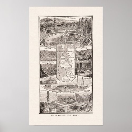
1886 Map of Monterey Bay and SF Bay Area Poster

- from our Affiliates


This is a map of the San Francisco Bay area from 1886. It is from the book "The Golden West" by Margaret Sidney; a travel log about a family that travels across country to California. The map includes SF, San Mateo, Redwood City, Mayfield, Mountain View, San Jose, Santa Cruz, Monterey, Gilroy, Haywards and Oakland. It also includes railroad routes of the area. The charming part of this map is the illustrations around the map. They include Menlo Park with the "Palo Alto” tree (for which the town would be named), Paso Robles, the San Jose electric light, Camp Capitola, Pacific Grove and others. Very nice combination of map and art! (Also see version with green mat included).


