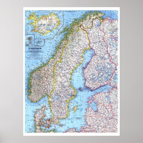
" Scandinavia: Map from 1963 ... Poster

- from our Affiliates


This detailed look at Scandinavia includes subtle relief, ocean bathymetry as well as various transportation routes including ferries. Published in April 1963, this map appeared with the article "Sweden, Quiet Workshop of the World." The 1963 Scandinavia map features: • Inset maps of Iceland, the Faeroe Islands, and Jan Mayan • Capitals, cities, and towns • 1938 Soviet boundaries • Mountains, rivers, lakes, lava, glaciers, and sand • Ocean bathymetry and currents • Superhighways, roads, railroads, railway ferries, auto ferries, and places with scheduled air service Coverage Area: Iceland, Norway, Sweden, Finland, Denmark


