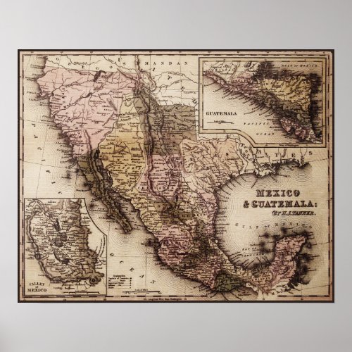
Historical Map Mexico and Guatemala Canvas Print


Historical map of Mexico and Central America in the first half of the 19th century prior to the Mexican-American War (1846-48). Note that the northern international boundary between the U.S. and Mexico is the current California-Oregon state line. Tubac is listed as "Ft. Tubac" and Tucson as "Ft. de Tubson"; designations which indicate their status as Mexican garrisons. It is interesting to note the "Russian Establishment" just north of the San Francisco Bay region. This map uses a different longitude system than is normal. The 0 degree of longitude is at Washington, D.C. instead of Greenwich, England. So all longitude lines are in degrees "west of Washington". The inserts show maps of the Mexico City area and parts of Central America. Cartographer: H.S. Tanner, Engraver: J. Knight, Publisher: Carey and Hart-Philadelphia, Reference: Tanner's Universal Atlas


