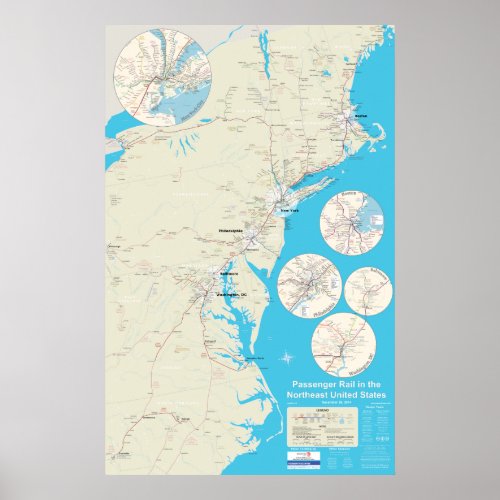
Northeast Rail Map version 2.1 - Dec 29, 2014 Poster

- from our Affiliates


Version 2.1 of the Northeast USA Rail Map, showing long distance trains, regional trains, commuter trains, and tourist trains. Map covers Maine, New Hampshire, Vermont, Massachusetts, Connecticut, New York, New Jersey, Pennsylvania, Maryland, Delaware, Washington DC, Virginia, West Virginia, and North Carolina. Close up maps show enlarged views of Boston, NYC, Philadelphia, Baltimore, and Washington DC. Please note that while the corner closeup preview blurs the image, your actual poster will print crisp. To view the map at full resolution please go to http://northeastrailmap.com/


