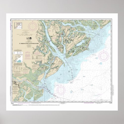
St Helena Sound to Savannah River Nautical Chart


This is NOAA chart 11513 titled, “St Helena Sound to Savannah River.†It covers an area from St Helena Sound south to the Savannah River and Tybee Island. The chart's scale is 1:80,000 at Lat 32°15'. Color shading on the chart indicates various water depths and land elevations. Depth Soundings are in feet. Also included on the chart are aids and hazards to navigation. NOAA is phasing out its paper charts. Electronic charts for onboard navigation are replacing paper charts. Certain products in my store utilize cropped elements on the chart. I have removed sections to improve the overall aesthetic quality of the image. Cropping and reprinting charts make them unsuitable for navigation. However, nautical charts are ideal for home and business decor. Framed nautical charts make great conservation pieces. Nautical charts printed on other products in my store make excellent additions to the decor in living areas, bedroom areas, and bathrooms. They are ideal for creating nautical decor themes and accessories. You can easily modify this design using the “Edit Design†button. The “Edit Design†button allows you to reposition the chart on a product. This feature also allows you to scale the size of the chart on a product. The nautical chart in this design is printed on other products in my store. The chart can also be used to create additional products not found in my store—by using the Zazzle catalog. To do this, scroll down to see the options for transferring this design to additional products. Significant Landmarks and Navigational References include Tybee Island, Savannah River, St Helena Island, Hilton Head Island, Daufuskie Island, Beaufort, Ladys Island, Port Royal Sound, Hunting Island, Palmetto Bluff, Calibogue Sound, Wilmington Island, Fripp Island, south end of Edisto Island, South Edisto Island, Fenwick Island, Hutchison Island, St Helena Sound, Chisolm Island, Coosaw River, Coosaw island, Hazard Neck, Checheese River, Harbor Town, Forest Beach, Skidaway Island, and the New River.


