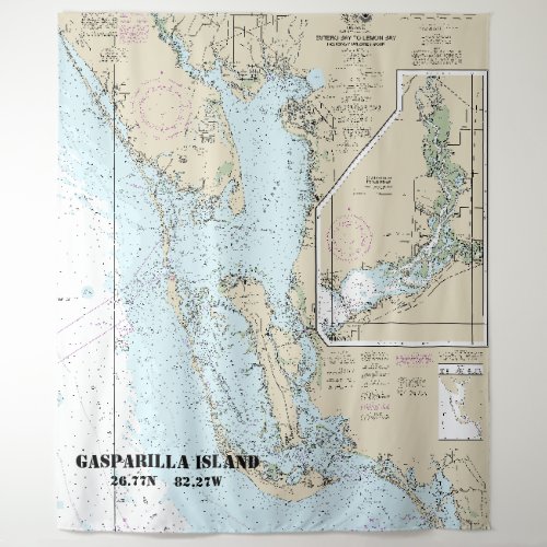
Estero Bay to Lemon Bay Nautical Chart 11426 Tapestry


This design is officially titled, “Estero Bay to Lemon Bay, Including Charlotte Harbor; Continuation of Peace River”. The chart is based on the authentic NOAA chart 11426. Original NOAA charts, such as this one, were designed for nearshore, coastal, Great Lakes, and harbor navigation. However, for anyone living on, or near the water, nautical charts make great decor items for the home or business. Some of the significant places and landmarks on this nautical chart include the following: Gasparilla Island, Port Charlotte, Peace River, Punta Gorda, Charlotte Harbor, Pine Island Sound, Sanibel Island, San Carlos Bay, and the continuation of the Peace River. The chart has been cropped to include the most significant areas covered by this chart, based on this product’s aspect ratio. The design for this product includes customizable places and coordinates. You can change the location from the one provided to something specific such as a town, city, landmark, a last name, boat or vessel name, or a point of interest. You can also change the coordinates to match the location you have named. At the bottom of the Personalization Options window, you can click on the link, “Click to Customize Further” to change the font location, font size, font style, and font color. Producing a customized nautical chart provides great diversity when considering decor for nautical, beach, lake, or coastal themes.


