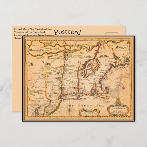
1600s New England Map Native American Settlements Postcard


This customizeable postcard features a restored reproduction of a Seventeenth Century Colonial Map of New England and New York circa 1676 by Francis Lamb, London. This map includes descriptions of locations of Native American "Indian" tribal communities. The New England Colonies of British America including Connecticut Colony, New Scotland, the Colony of Rhode Island and Providence Plantations, Massachusetts Bay Colony, Plymouth Colony, and the Province of New Hampshire, as well as a few smaller short-lived colonies. Other indigenous American tribes and places denoted on this map include: Iroquois, Seneca, Minqua, Mohican, Pequot, Quebec, St. Lawrence River, Connecticut, Esopus, Minisink, Albany region, New Jersey, Susquehanna, Manhattan, Long Island, Staten Island, Maine, Kennebec, Boston and Cape Cod. You can easily change the text spelling; font style, size and color with the Zazzle personalization button.


